Products
Sonar4 & Sonar5-Pro Post Processing Systems
Made by Scientists – For Scientists
Easily used for Biomass estimation, Tracking, Macrophyte, Multi freq. Multi beam, Dynamic sound profile, Data insight, Classification, Statistics, Maps, Pictures, Crossfilter, Single echo, Bottom and water current detection, Fish sizing, Oscilloscopes, 3D-Amp and phase diagrams, Ray tracing, Transducer position prediction and many more…
Sonar X Biomass Estimation software
Sonar 5-Pro: Study echoes in a layer with oscilloscopes
What SonarX can do
Sonar5 has all the option. For Sonar4, tools related to standard biomass estimation and simple tracking are available.
Pre-analysis
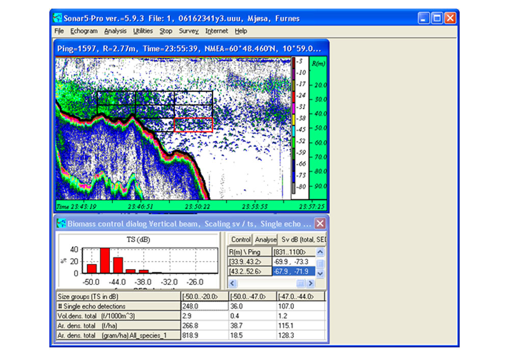
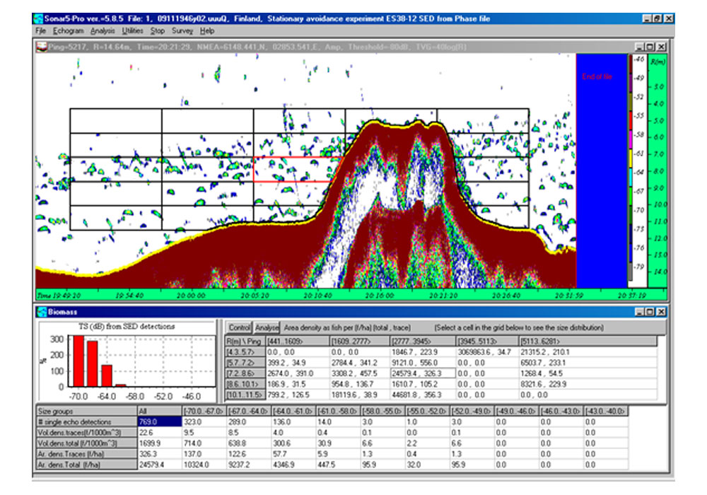
- Single echo detection
- Bottom detection. (Enhanced with image analysis)
- Max range detection
- Dynamic sound speed and alpha correction
- Passive noise subtraction
- Heave correction
- Manual noise erasing tools
- Automatic noise reduction systems, unwanted target removal
- Water current detection
Analysis
- Biomasse estimation
- Tracking and tracing
- Macrophyte
- Track statistics
- Image analysis
- Multi frequency analysis
- Synchronized echograms with DIDON movies
- Export of bathymetric data
Data insight
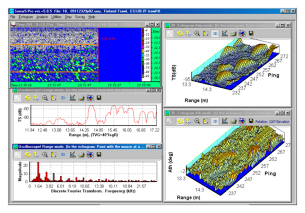
- 3D-echogram
- Oscilloscope
- DIDSON movie player
- Frequency response function, classification maps and RGB echograms
- TS range distribution, Size distribution,
- Integrams
- SED detections versus off axis angle
Interpretation
- Fish database
- Catch data
- TS to weight and length calculator
- Track aspect TS correction
- De convolution for estimation of size when aspect is unknown
- Ray tracing for estimation of targets and beam in hor. app.
Presentation
- Transect maps
- Tracked echoes in all aspects
- Tracks relative to surface and bottom profile (horizontal app.)
- Tracks relative to water current (horizontal app.)
- Photos, drawings and maps
- Free threshold.
- Free color per dB scale
- Time, ping number, and range
- Geographical positions and sailed ship distance.
- Zoom in and out
- Layers: Pelagic, Bottom, Free number of sub layers and sub segments
Noise
- Manual and automatic noise removal systems
- Noise filtering
- Target noise separator.
- Track filtering
- Passive noise subtraction
Editors
- Noise editor
- Bottom editor
- Text editors (txt, rtf)
- Bottom profile editor
- Water current editor
- Graphical transducer positioning tools
- Event notes editor and browser
File overview and file opening
- Simple file open dialog presenting only filenames
- Advanced file open menu presenting filenames with record number, survey description, transect description, additional text description and photos
- Graphical presentation of transects in digital maps
- Opening of echograms at positions selected graphically from maps
- Quick file change functions